Developing Worldschooling Curriculum: Maps
Map skills seem to me important for any self-respecting worldschooling kid, and this area of study can entail fun activities during summer vacation—whether at home, on a trip, or a combination of the two. I developed a learning module on maps for my three kids, then ages four to 10, while we were living in Peru for a few months, and this proved to be a valuable and engaging theme for all of us. In our case, I decided to use the Peru-Japan connection, as a theme for our map skills study—if only because it is intriguing and allowed us to go from local to global in one study module. Perhaps the following examples will inspire you to create your own map skills study plan, wherever you are.
We studied the geography of both countries and their geographic contexts in a variety of ways.
- I scoured the internet and a local bookstore for resources, which included e-books, Wikipedia, CIA Factbook, Encyclopedia Britannica, news articles, children’s books with cultural stories or lively pictorial maps, and Facebook “community” groups in both countries.
- Through reading that I assigned to them and that we did together, we learned about the history of Peruvian-Japanese relations, the ring of fire and related earth science, Nikkei cuisine and cross-cultural exchange.
- We played quiz games about their regions topographic features, key historical facts and cultural points of interest.
- We reached out to different friends who had spent time in Japan and video-chatted with them from Peru; I had my kids prepare a few questions in advance, and the friends shared photographs and stories from their experiences.
- We enrolled our kids in extracurricular activities in Cusco (which I found by asking around and searching online) so that they could meet and interact with Peruvian peers.
- My daughter joined a local origami club in Cusco (which I found via Facebook) that organized exchange visits and conferences among Japanese and Peruvian origami artists; she attended club meetings weekly, and one of the members even came to our apartment to help all three kids practice origami while we parents worked.
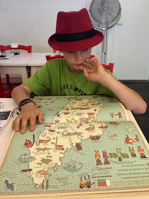
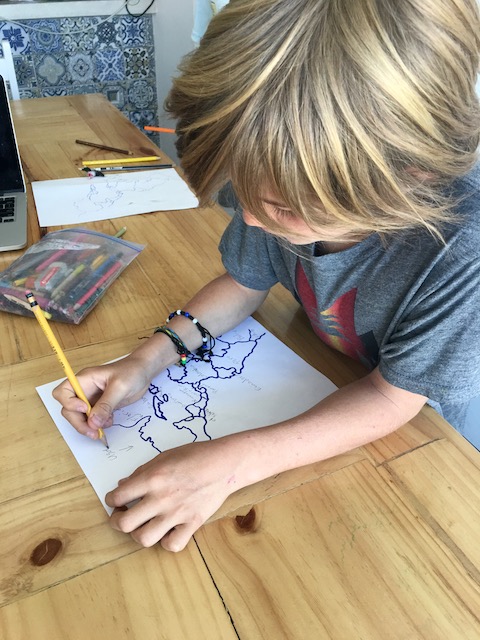
- Toward the end of our study, I traced blank maps of Japan’s islands and the South American continent and then challenged the kids to label them with island/country names, capital cities, oceans, mountains and rivers—first, off the top of their heads, and then using maps to fill in any gaps.
For an applied map skills component, I incorporated several hands-on elements over one intensive week.
- Each of the kids had to draw a floor plan of our rental apartment in Cusco, which proved to be a challenging and time-consuming exercise in understanding and depicting spatial relationships; we then walked through the apartment as a family, using each of their “maps” as a guide.
- Venturing a little further afield, I drew a map of our neighborhood with some landmarks around town and created a scavenger hunt, where the three kids had to work as a team to navigate the city and find the clues (with me following behind). Their tasks included hailing a taxi and giving directions (in Spanish) to the driver (while I stayed mute), and then traversing blocks on foot as they looked for signs and buildings plotted on their map (one was the Japanese-Peruvian association community center).
- As a reward for their hard work, their last point to find led us to a Nikkei restaurant, where we ate a Japanese-Peruvian fusion lunch and the waiters spontaneously folded origami for the kids.
- We invited our kids to create their own maps of our local neighborhood with street names and some landmarks of interest to them—like the playground and where the barking guard dog lived. One of them was so inspired that he took to drawing maps of imaginary islands and communities that he dreamed up and compiling them in a special notebook, just for fun.
- From then on, we made a point of having the older kids look up directions to places we were going, like the local market, and take turns being in charge of navigating to lead us there.
If you are thinking about incorporating map skills into your kids’ summer activities, here are some suggestions to spark your creative planning:
- Work in concentric circles: What can they do, learn and practice at home, in the neighborhood, in the broader city or region, and even halfway around the world, whether traveling or not? Does your town have a sister city, a historical connection to another country, or could you use your holiday destination as a jumping-off point for map skills? Drawing the floor plan of their very own home can be as rich and challenging as learning to navigate a new place by following a map—and the two activities complement each other well. Putting these together with the study of a world or regional map with topographic features makes for a well-rounded map skills module.
- Think multimedia: What resources can you dig up to make the study colorful and engaging? In addition to reading/perusing that your children can do themselves, consider audio-books or a grown-up reading aloud. History and geography books? Magazines at the library or a periodical shop with a wide selection? Children’s pictorial maps and storybooks? Fun sticker books on regional costumes or related coloring pages that you download and print? A documentary for the family to watch over dinner? A feature film that takes place in the city or country of interest? A hands-on creative activity, like the origami in our context—maybe painting, drawing or sculpting a representative map, architectural style or topographic feature of one of the places you have chosen as a focus?
- Make it multi-sensory: Is there representative music that you could incorporate into the week, such as putting on a relevant playlist over breakfast each morning? Could you find a local museum, or a musical or theatrical performance that corresponds with your theme? How about food—can you come up with a recipe that you cook together, or an illustrative menu that you serve, or a special restaurant outing for dinner together one evening? Is there anyone you know or could meet to have a direct conversation about the place (even if it is your own hometown)? Thinking about ways to approach the geographic theme from all senses can foster creative ideas that may not otherwise have occurred to you.
- Have fun with maps and multifaceted learning with your kids!
0 Comments Add a Comment?